Showing posts with label Utah tourism. Show all posts

Thursday, November 17, 2022

Potpourri


I'm a Jeopardy! fanatic. I DVR it so I don't miss any episodes. One of the occasional categories on the TV quiz show is Potpourri. (It happened just last week during the Tournament of Champions.) If Jeopardy! can do it, I suppose I can follow suit.

Thanks to anyone who's "traveled" with us through multiple blogs featuring the National Parks of the Southwestern U.S. Even though I didn't share all 1,000+ of the photos I took, the number was still plentiful. And here are a few more. 

Paul Harvey always talked about "the rest of the story." Here are some photos from "the rest of our journey." (Alex Trebek and Paul Harvey: How can I go wrong?)

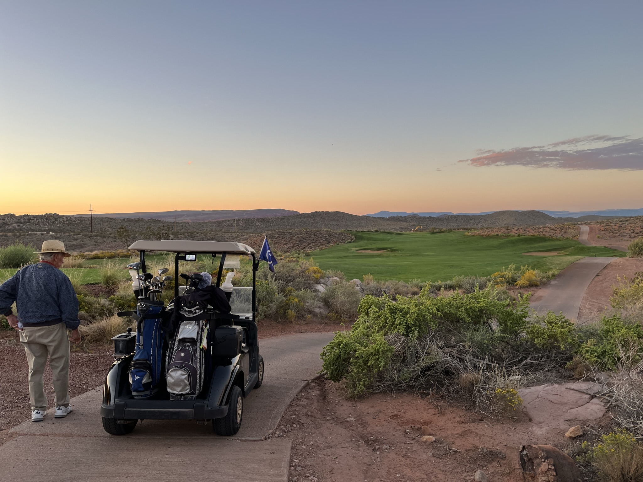
The first hole - Coral Canyon Golf Course

Randy golfed one morning at Coral Canyon Golf Course in St. George, Utah. He and a husband/wife duo from Colorado were the first to tee off that morning. 


For Randy, it ranked among the most beautiful courses he's ever golfed. 


As is customary, I had a book along. However, it was not customary that I didn't crack the book during the entire morning. My other golf accessory - my camera - was called into action.

While we had to get up early to be the first to tee off, I was glad for the cool morning. Later in the day, it would have been hot.


While we were in St. George, Randy kept getting asked whether he was competing in the Senior Games, which were going on at the time.  Our hotel was home base for a whole lot of tall, "mature" men and women. Every time someone asked him if he was a competitor, his grin got a little bigger. Evidently, some of the senior games people played the Coral Canyon golf course for a golf tournament a few days after we were there. Alas, it was not Randy. 

Because we got such an early start to the day (and Randy wasn't competing in any official events at the Senior Games), we added Snow Canyon State Park to our itinerary. The officiant at Brent's and Susan's wedding used to live in Utah. She gave us several suggestions for restaurants and also mentioned Snow Canyon as a favorite place for their family. (Thanks, Allison! It was so helpful to have some insider knowledge!)


Snow Canyon State Park is a 7,400-acre park tucked amid lava flows and sandstone cliffs. Created in 1959, it's located in the Red Cliffs Desert Reserve. 

At the Pioneer Names Trail - We couldn't find the names, but the pamphlet said the trail passes pioneer names, written in axle grease, dating back to 1881.

 We may not have found the names, but we "pioneers" from Kansas took photos there anyway.


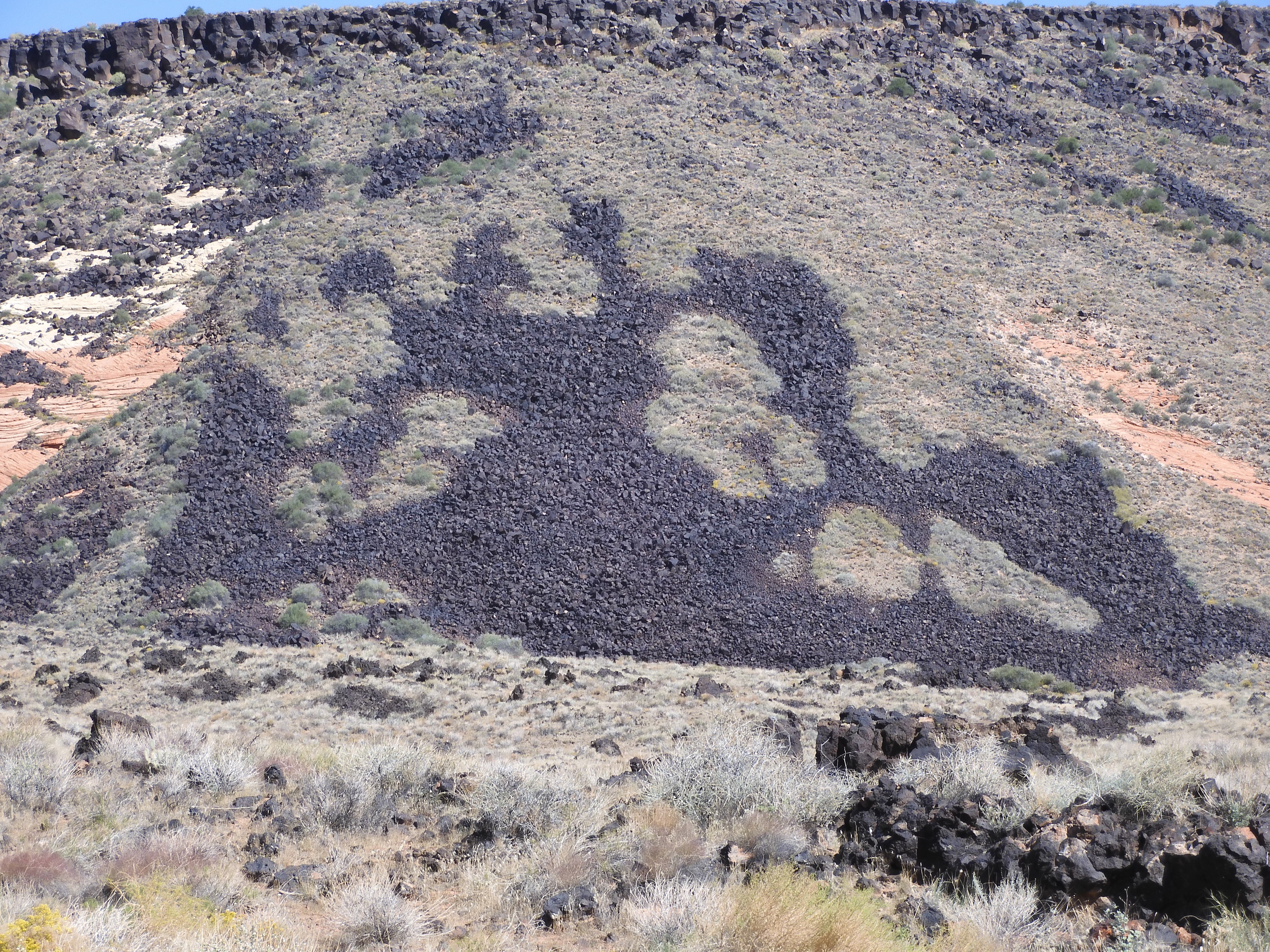
While many of the rock formations were red and others were sandstone, there were also lava flows. This lava flow was said to look like a butterfly. I can see it: Can you?
Snow Canyon was also the setting for several famous movies, including Butch Cassidy and the Sundance Kid, High School Musical 2 and John Wayne's The Conqueror.  

That wasn't the only movie location we visited. Our trip home included brief photo stops in Monument Valley. 

Monument Valley is known as John Wayne Country. He starred in five films there: including "Stagecoach" (1939), "Fort Apache" (1948), "Rio Grande" (1950), "The Searchers" (1956) and "She Wore a Yellow Ribbon" (1949). Other movies filmed at Monument Valley include Forrest Gump, Mission: Impossible 2, Easy Rider, Back to the Future Part III, National Lampoon's Vacation and the 2013 version of The Lone Ranger.

It rained that day and was overcast.

As we traveled toward Durango, we even saw a flash flood. (I didn't get a photo of that.)
We were hoping to bring the rain home with us, but, unfortunately, that didn't happen.

We traveled 3,070 miles during our 12-day trip. I really did take more than 1,000 photos. We were both ready to be home, but Randy is already thinking about the next adventure. This resident "homebody" will likely take a little longer to be bitten by the travel bug again.

The purpose of life is to live it, to taste it, to experience to the utmost, to reach out eagerly and without fear for newer and richer experiences.
-- Eleanor Roosevelt


Tuesday, November 8, 2022

Advice from Zion


A bookmark from Zion National Park had this message:
 
Advice from Zion:
Carve out a place for yourself.
Aspire to new heights.
Stand the test of time.
Don't get boxed in.
Listen to the voice of the wind.
It's OK to be a little off the wall.
Reach deep!
 

We were at Zion National Park three different days. Our first glimpse of Zion was a scenic drive through Kolob Canyons as we traveled from Moab to St. George, Utah. 

As with all our national parks itinerary, there were plenty of "rocks" there. But it added a dose of fall color, something I was looking forward to during our trip.

Kolob Canyons Road is one of the least visited parts of Zion. I think it was a hidden gem.

On our second day at Zion, we drove our Jeep on the 18-mile-long Zion-Mt. Carmel Highway.

As we winded our way up the road, we saw holes in the canyon wall.

We soon discovered it was part of a 1.1-mile tunnel through the rock.  


In the 1920s, the canyon appeared to be a dead end. Highway engineers devised a tunnel by drilling small shafts into the north-facing cliff. The shafts later became the tunnel's windows or galleries. The four galleries are not only a source of light and air but were places for workmen to expel rubble as they tunneled toward both ends.

When the tunnel and highway were completed in 1930 (at a cost of 1/2 million dollars), they opened the region to motor tourism, linking Zion to Bryce Canyon and the Grand Canyon's North Rim. Now the tunnel itself has become a kind of barrier, as today's RVs and tour buses are too large for two-way traffic within the tunnel. That creates delays as oncoming traffic is held to allow oversized vehicles to pass. 

Checkerboard Mesa was named by Preston Patrow, the third superintendent of Zion. Standing at 6,670 feet, it was named for its checkerboard appearance caused by the horizontal cross-bedding of ancient sand dunes and vertical cracking due to expansion and contraction of the sandstone during winter.

At one of the vistas, I again marveled at the tenacity of plants in the unforgiving soil. 


It wasn't just in sandy soil. Plants still took hold even in the rocky surfaces of the cliffs.


 The plants weren't the only living things on the rock walls.

Light and shadows changed the scenery from moment to moment.

 
Before we left for the day, we stopped at the Human History Museum at Zion, and I took this panoramic shot.

Dwarfed by the scenery, people often have responded to Zion's features by naming peaks, relating the stone monoliths to human or spiritual drama. Four such names are in this photo: West Temple, Sundial, Altar of Sacrifice and Beehive.
 
As with many of the national parks we visited, it was people in the last century who recognized the value of preserving places like Zion as national parks. In the 1870s, Major John Wesley Powell and Frederick Dellenbaugh of the U.S. Geological Survey explored the Colorado River and Zion region.
Their colleague, Capt. Clarence Dutton, praised Zion in his 1880s USGS report by writing about the canyon's unforgettable and exquisite scenery. Photographers and artists began to portray the majesty of Zion in books and on canvas. 

In a 1904 article for Scribner's magazine, Dellenbaugh described the canyon as a "new Valley of Wonders." His words influenced government designation of the canyon as Mukuntuweap National Monument in 1909. It became Zion National Park in 1919.

Since 2000, access to the Zion Scenic road is available only via park shuttle during most of the year.  Since we couldn't find parking the first day, we opted to return early the next morning to catch a shuttle. This was good in a couple of ways: 1) We wouldn't fully experience the park without riding the shuttle; and 2) It gave Randy a chance to "gawk around," since he didn't have to drive.
 
Taken through the shuttle windows
 

The first stop was the Court of the Patriarchs, which is reflective of the history of the region.

Named for three towering figures of the Old Testament - Abraham, Isaac and Jacob - the sandstone cliffs hold court over Birch Creek Canyon and the Virgin River. To escape religious persecution, Mormon leader Brigham Young led settlers to Utah in 1847. Within a decade, 28 families were called to go to southern Utah - to "Dixie" - to begin a cotton mission. In 1863, Isaac Behunin was the first non-Indian to settle in the canyon and the first to call it "Zion," a Biblical reference to a "place of refuge." 

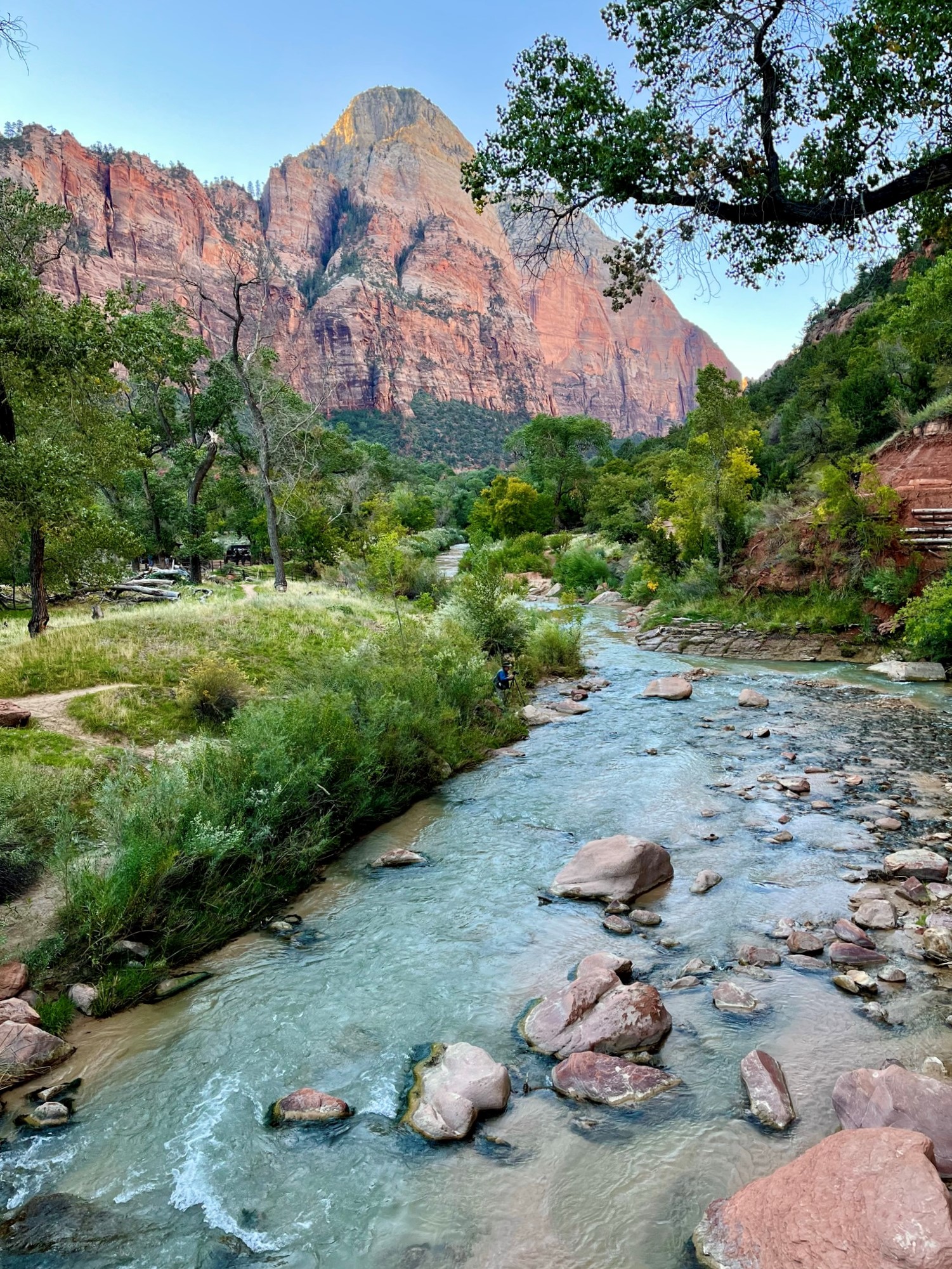
Our shuttle ride also gave us an opportunity to walk along the Virgin River, getting a totally different perspective. 


In every walk with nature one receives far more than he seeks.
Naturalist John Muir

The walk along the river was one of the favorite experiences in Zion for both Randy and me.


While we could have climbed higher into The Narrows, we turned around at a grotto.


 On each journey, you will be able to see the might and majesty of the canyon, from beside the river or from high on the rim. ... These colored cliffs will always be the basis for Zion Canyon's history; the rock, the flora and fauna, the people and the park endure.
J.L. Crawford, 2001

J.L. Crawford (1914-2011) was born in a lumber shack on the family farm, where the Zion National Park headquarters stands today. As he grew up, Crawford saw Zion park develop. As a teenager, Crawford began working part-time as a dishwasher at the Zion Lodge. It would be the beginning of a life-long relationship. Eventually, he worked two seasons as a naturalist and officially became a park ranger in 1948. 


We'd have to agree with his assessment of Zion, as quoted in a display at the Human History Museum there. Each of our three "journeys" into the park provided a different glimpse at the natural beauty - each reflective of the canyon's majesty and another reminder of the beauty of God's Creation.


Thursday, November 3, 2022

Woohoo for Hoodoos


Halloween week sounds like the perfect time to talk about "hoodoos." No, not "voodoo" - hoodoo. But it was a "woohoo" visual treat for the senses to tour Bryce Canyon National Park.


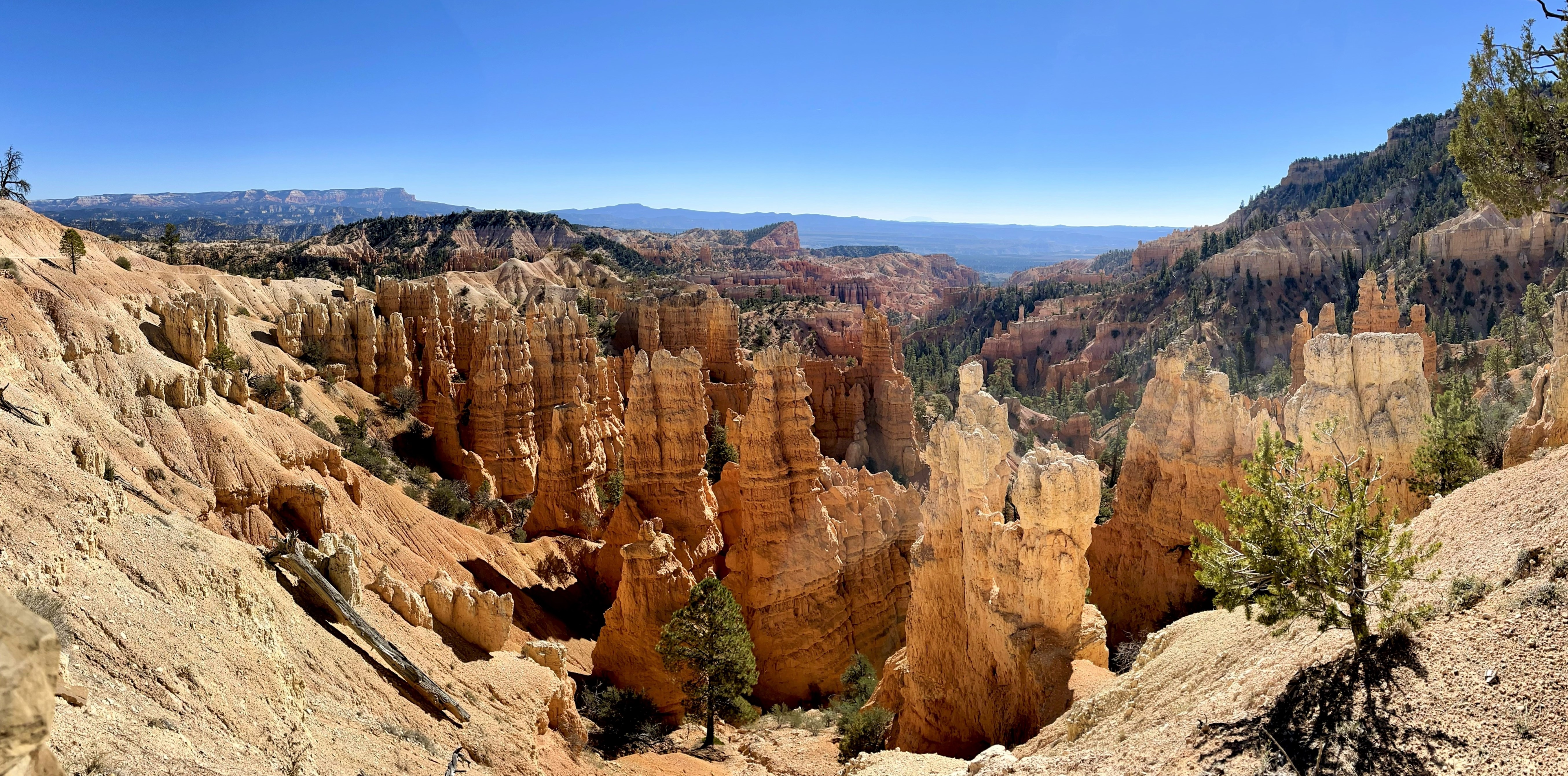
Hoodoos are the name given to the rock spires in Bryce Canyon. These fairytale-like spires rise below the cliffs of the Paunsaugunt Plateau. Much like my kids and I used to find shapes in the clouds over Kansas, tourists find "characters" in the spires formed in the soft limestone into shapes that look like sand castles, Gothic cathedrals and princess lairs. But modern-day visitors aren't the first ones to find them intriguing. The Paiute tribe, who came through the area on seasonal hunting and gathering expeditions, attributed them to the Legend People transformed by Coyote into rocks. 


It's not just the shapes that are almost as individual as fingerprints. Hoodoos don't grow like trees but are eroded out of the cliffs where rows of narrow walls form. These thin walls of rock are called fins. Frost-wedging enlarges cracks in the finds, creating holes or windows. As windows grow, their tops eventually collapse, leaving a column. Rain further dissolves and sculpts the limestone pillars into bulbous spires called hoodoos. The climatic balance between snow and rain ensures that new hoodoos will emerge, while other become reduced to lumps of clay.


The colors also change in sun and shadow, revealing the different hues of reds, oranges, pinks, yellows and creams.


Bryce Point provided a lesson in those differences. Bryce Canyon was established in 1928. It includes 35,835 acres. 


Actually, before you even arrive at Bryce Canyon proper, there's a little bit of fairytale magic. We passed through two man-made tunnels as we traveled from St. George, Utah, through the Red Canyon to Bryce Canyon. 


On June 1, 1925, a 315-car caravan led by Governor George Dern, arrived at the Red Canyon tunnels to celebrate the opening of Utah National Park, later renamed Bryce Canyon National Park. A flower-strewn gate closed the entrance to the second tunnel and a banner proclaimed, "Welcome to Utah's Fairyland." 

The tunnels were the brainchild of W.J. Humphrey, Powell National Forest supervisor, who, upon visiting Bryce Canyon in 1915, said this:

"We came upon what I have always considered the most beautiful piece of natural scenery on the face of the earth."

Randy and Smoky

As we first arrived, the hoodoos seemed to grow out of the rocks like the ponderosa pines of the Dixie National Forest.

Farview Point, Elevation 8819
Maybe, someday, these cliffs (below) will become hoodoos, too. Farview provides a panoramic view of Table Cliffs and a series of platforms stair-stepping to the Kaibab Plateau.

At Agua Canyon (elevation 8800) two prominent hoodoos command attention.


On the left is the taller of the two towers, "The Hunter." To the right is a hoodoo commonly referred to as the "Rabbit." In the early years of Bryce Canyon National Park, an effort was made to name many of the more prominent hoodoos. However, through the years, many of these have fallen or partially fallen so that they look nothing like the things they were originally named for. As a result, hoodoos are no longer being named. Navajo Mountain looms on the distant horizon.


Agua Canyon overlook

One of my favorite stops was the Natural Bridge. The natural arch is 85 feet long and 125 feet high. Its bright rusty red contrasts with the green of the trees below and the deep blue of the sky.

I couldn't resist including a little fall color.

At the Bryce Point scenic outlook, one side looked like a sand castle to me.

But, turn just 90 degrees or so, and the coloring and shapes changed markedly.

Maybe that long-ago Utah governor had it right when he called the park "a fairyland." Fairyland Canyon seemed an appropriate name for this outlook.


As a side note, while at Bryce Canyon, we stayed at Ruby's Inn (now a Best Western). Ruby's Inn has been hosting guests to the area for more than 100 years. In 1916, Reuben C. (Ruby) Syrett brought his family to the wilds of southern Utah and established a ranch. A few weeks after his arrival, another rancher told Ruby of the canyon called Bryce. They also began telling people about the beauty of the canyon. In 1919, Ruby obtained permission from the state to build a lodge, the Tourist Rest, near the brink of the canyon.

In 1923, when Bryce Canyon become a national monument, he moved the establishment to  his ranch and called it Ruby's Inn. Today, it's a huge motel with restaurants, art gallery and shopping.