Thursday, October 27, 2022

Nature Is Full


On a trip to Rocky Mountain National Park a few years ago, we couldn't go to one of the lakes we'd planned to visit. Too many visitors were already at that location in the park, and an electronic sign turned additional visitors - including us - away. At the time, we joked, "Nature is full!"

It happened again during our retirement trip. We had planned to visit Arches National Park. And even though we were there by 8:15, the electronic sign said that it was full. No more vehicles could enter the park for at least 4 to 5 hours. 

Nature was full AGAIN. This time, we went for Plan B - the Canyonlands National Park. And, as it turned out, we went to Arches the next morning before sunrise, and it turned out to be even better anyway. (More on that to come.)

But even Canyonlands required a wait, as we found when we arrived. I took a photo of this sign, but we also went by one that prophesied a 1-hour wait. So we listened to our audio book ... and we waited. We had planned our trip for October, thinking summer crowds would have cleared out. I'm sure the crowds were less, but evidently, other people had the same idea we did! We were also hoping for more moderate weather, and it was better than it would have been during the summertime heat in the desert climate.

Canyonlands is part of a region called the Colorado Plateau, an area that stands high above the surrounding country. At first, that was confusing to me, since it's in Utah, but the Colorado Plateau doesn't mean Colorado, the state. About 20 million years ago, movement in the Earth's crust began to alter the landscape of North America, building modern landforms like the Rocky Mountains, Nevada's Basin and Range, and the Colorado Plateau. Some geologists believe that the plateau has risen as much as 10,000 feet since the uplift began.

As a side note, I couldn't resist buying a children's book, Scout Moore Junior Ranger on the Colorado Plateau.


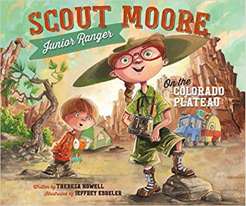
For one, Moore is my maiden name. And I figured it could double as a gift for Kinley and Brooke. (That wasn't the only souvenir for them - or us.)

On the Colorado Plateau, water and gravity are the region's prime architects, and those elements cut flat layers of sedimentary rock into hundreds of canyons, mesas, buttes, fins, arches and spires.

Canyonlands is one of the U.S.'s more recent national parks. It was established in 1964. Up until that point, the remote area in southeastern Utah was largely unexplored - except for Native Americans, cowboys, river explorers and uranium prospectors. 


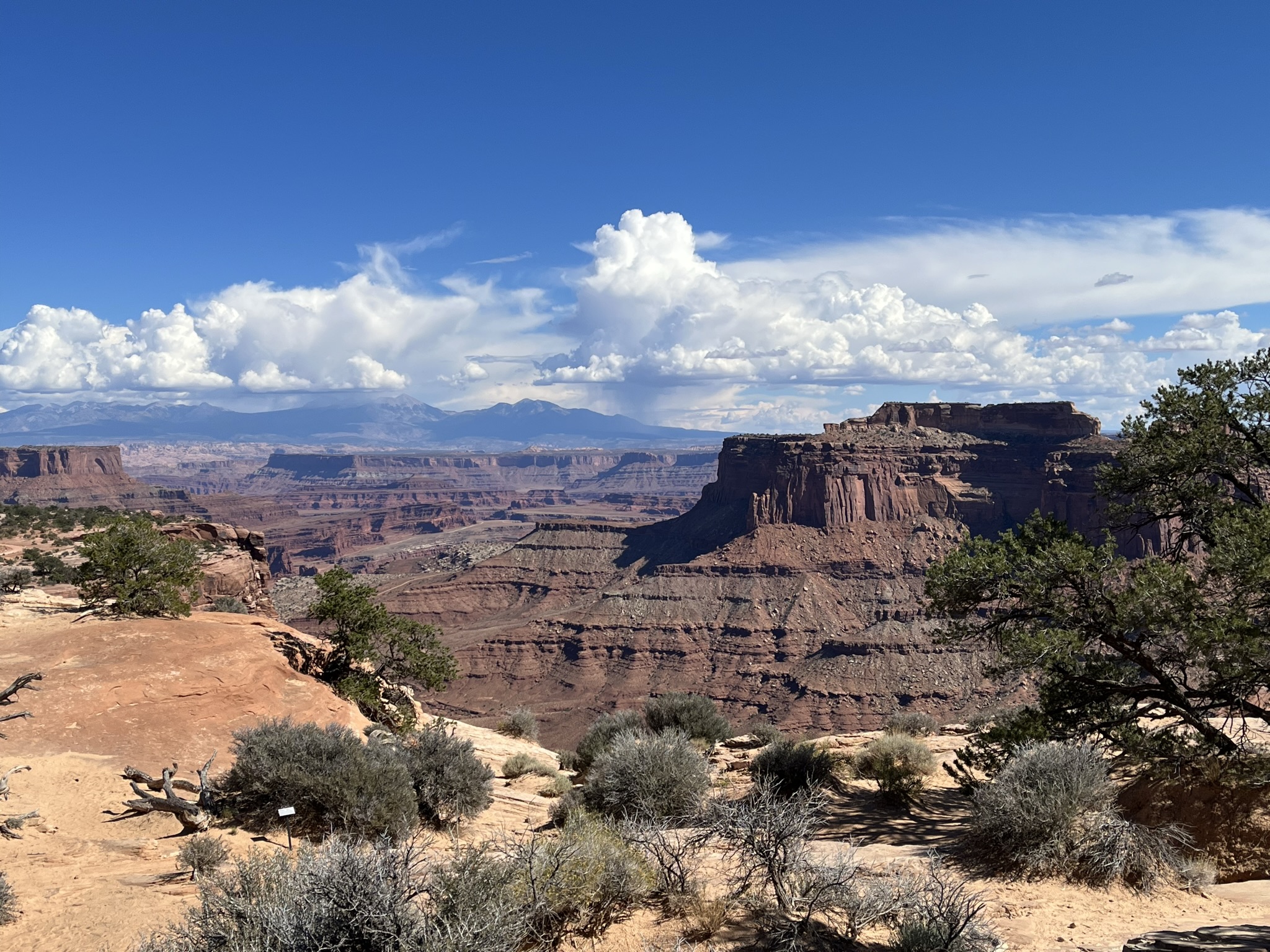
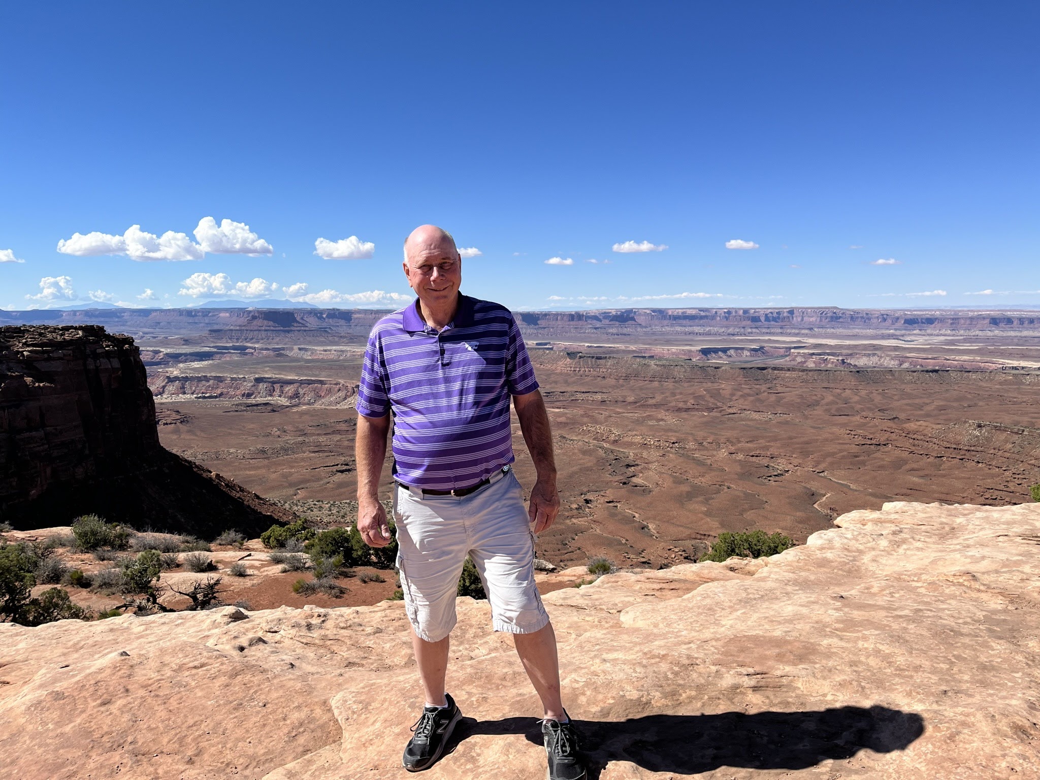
However, it's proximity to Arches and other natural wonders makes it a destination these days for tourists like us. Desert mesas plunge thousands of feet into canyon webs. 

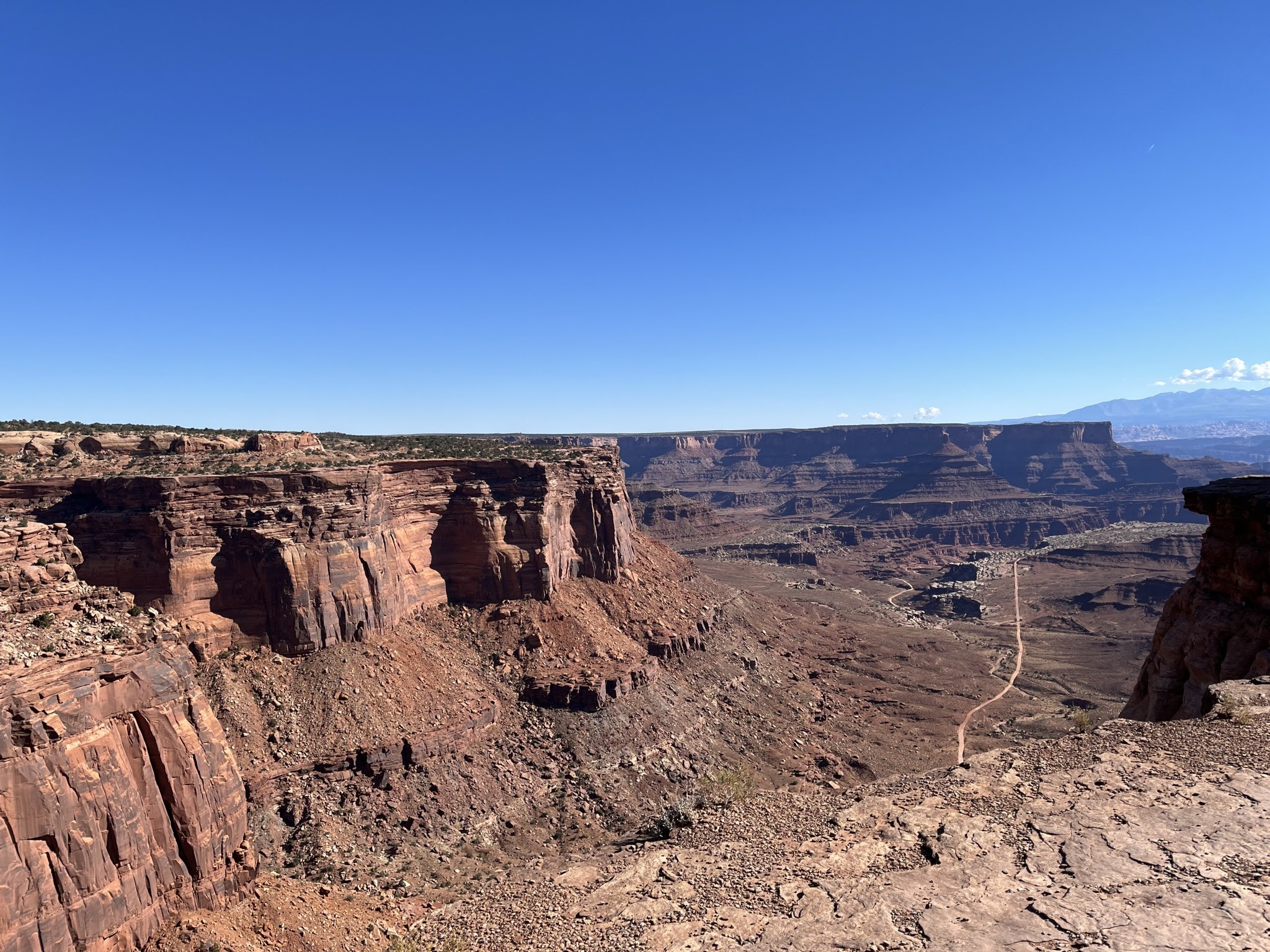
Just like many of the national parks we toured this fall, we could have seen more of it had we taken our Jeep off road. 

You can see one of the roads in this photo.
  

However, there were also plenty that hugged the cliffs and would have required one-way traffic, while balancing on the edge, like in this photo. We opted no!

 We also didn't choose to explore via glider, like a couple of other people we saw! 


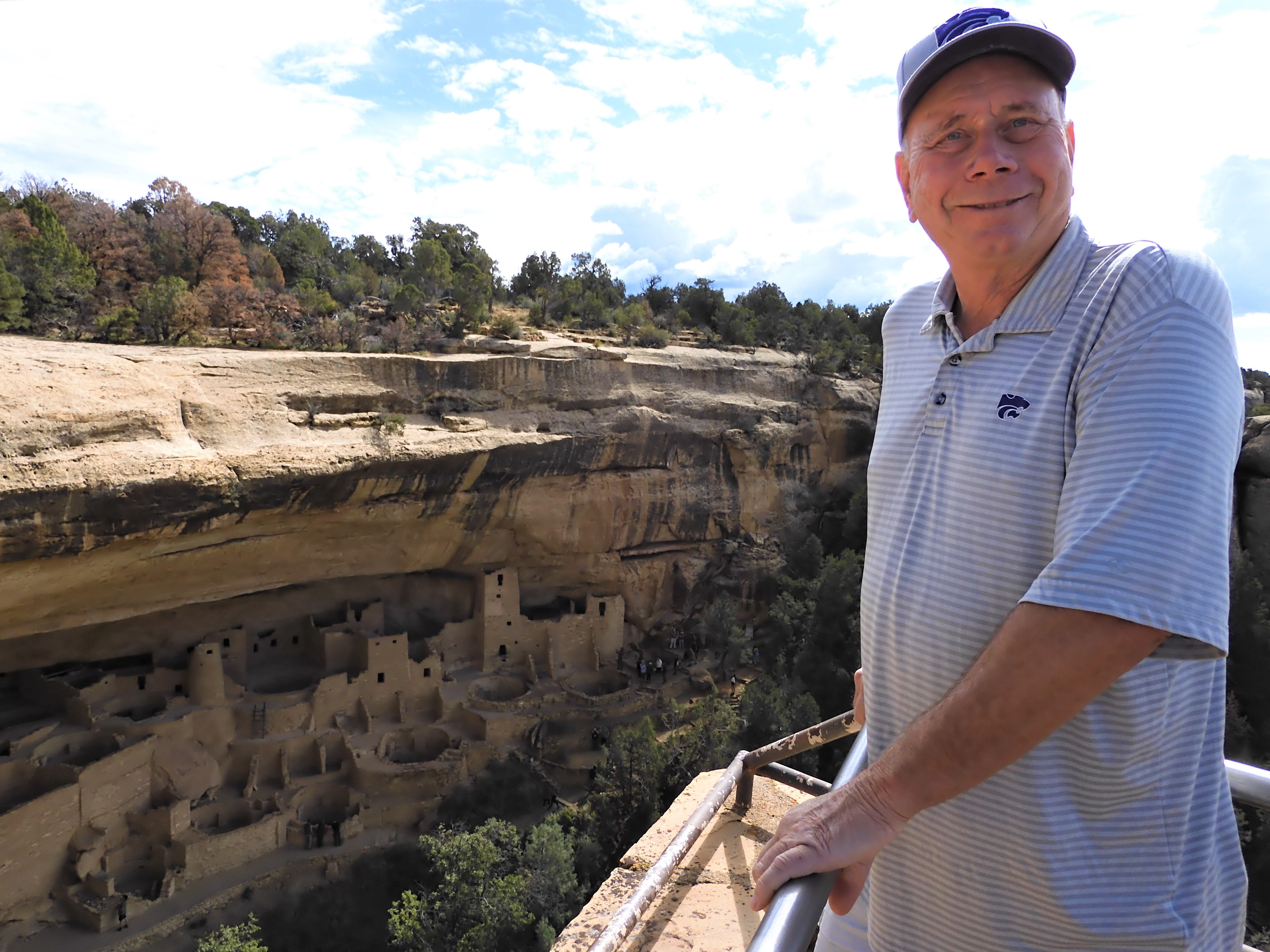
And, just like with Mesa Verde and most other destinations on this trip, we didn't hike long distances, so we didn't explore every corner. But the overlooks still gave us a glimpse at the stark beauty.


Like other national parks in the area, Canyonlands pays tribute to the Ancestral Puebloans and the Fremont people, forebearers of the Ute, Paiute and Navajo tribes. 

Upheaval Rock, Canyonlands

In May 1869, Major John Wesley Powell set on on a mission to explore the uncharted canyons and waters of the Green and Colorado Ricers. Powell, a geology professor and Civil War veteran, began the journey with nine novice oarsmen and four wooden boats. He ended the journey three months later with two boats, six men and new knowledge of a unique landscape. 

As they entered the wilds of the canyon country, Powell wrote in his journal, "What shall we find?" When Powell's party reached this section of the river, he described a "strange, weird, grand region of naked rock with cathedral-shaped buttes, towering hundreds or thousands of feet, cliffs that cannot be scaled and canyon walls that shrink the river into insignificance."

You can see the river in the upper right quadrant of this photo that I took using my telephoto lens.

With even more telephoto power, we could actually see some green along the river.

The Green River begins in the Wind River Range of Wyoming and joins the Colorado River 20 miles below this point at the confluence. 

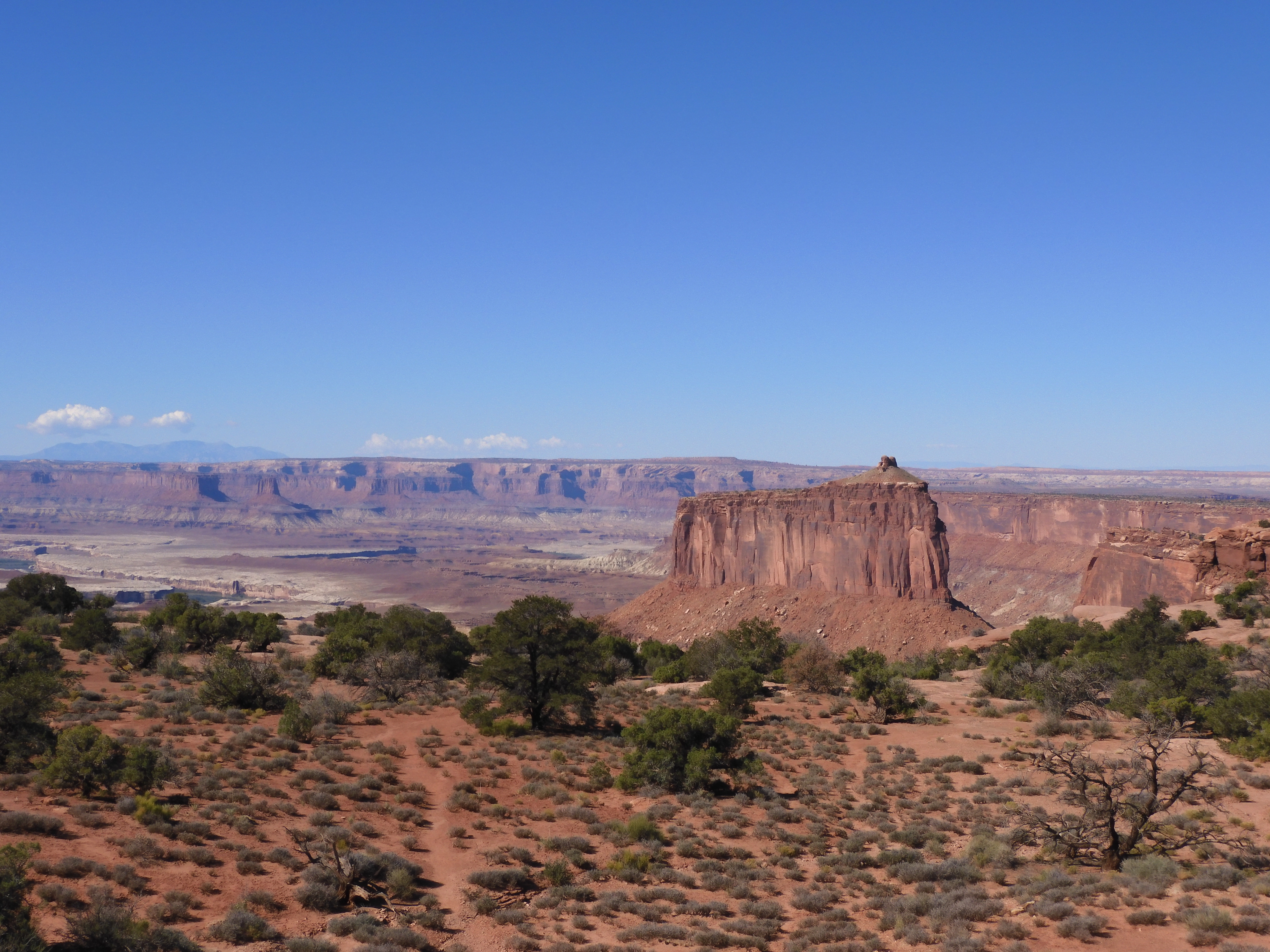
 This was at Grand View Point.
Randy did hike down the Grand View trail for a closer view. I stayed on stop and took photos. (Big surprise!)


 You can take the farmers off the farm, but we still notice things like signs for cattle crossings. 


I'm guessing more people ask about bighorn sheep when visiting the ranger stations, but I asked about how many cattle were grazing the Canyonlands. The first ranger said, "a whole lot." The other ranger said around 200. We didn't see any of them, though that's not surprising, considering the national park encompasses 337,598 acres. (Everything is relative, I suppose, but 200 cattle didn't seem like "a whole lot" to us.)

While there was vegetation along portions of the plateau and mesa, today's landscape is one of erosion. The Green and Colorado Rivers began carving into the geologic layers, exposing buried sediments and creating the canyons of Canyonlands.


However, the rivers aren't the only force of erosion. Summer thunderstorms bring heavy rains to the landscape. Some layers erode more easily than others. As softer rock dissolves away, layers of harder rock form exposed shelves, giving the canyon walls their stair-step appearance. Occasionally, a slab of harder rock will protect a weaker layer under it, creating balanced rocks and towers. 


Island in the Sky is the Canyonlands' observation tower. On a clear day, it can provide a glimpse of three mountain ranges - the La Sals, the Abajos and the Henrys.

Tuesday, October 25, 2022

The Power of Teachers


We returned last week from a nearly two-week trip to U.S. National Parks in Colorado, Utah and Arizona. As I tell people, we saw a lot of rocks. And that's true, though it's amazing how different "rocks" can look. It will take awhile to sort through hundreds of photos. Nobody wants the stereotypical slide show from "Aunt Fritz," displaying every photo on "how I spent my summer vacation" - or, in our case, a blow-by-blow account of what we are calling our "retirement trip."


It's hard to choose favorites from our trip. Both Randy and I have several places or experiences that could qualify. But I am convinced that there is an underlying reason for Randy's love of Mesa Verde. It was the first stop of our six National Park visits. However, I think a long-ago second grade teacher is the reason that it was among Randy's favorites.


Granted, it's been a long time since second grade ... for both of us! 

Undated photo of Randy, but likely about 2nd grade

However, Randy's second grade teacher - Laurabel Simpson - loved geography and travel. Even though it's been nearly nearly 60 years, Randy still remembers Mrs. Simpson telling his class about her trip to Mesa Verde. 

It probably hit closer to home for us because our younger granddaughter, Brooke, is currently a second grader. We already knew the importance of teachers in the lives of their students. But maybe comparing that travel enthusiastic second grader from 59 years ago to the 2022 version made it even more poignant.

Mesa Verde National Park was created in 1906 to preserve the archeological heritage of the Ancestral Pueblo people, both atop the mesas and in the cliff dwellings. 


I had been to Mesa Verde with my family when I was in elementary school. I vaguely remembered it, but I must confess that my memory is not my best asset. Randy had never been.

Cliff House

The Cliff Palace is the largest cliff dwelling in North America. It is composed of at least 150 rooms and 21 kivas. It was surrounded by an active community, and it likely served as an important gathering place, perhaps an administrative center for many Ancestral Pueblo villages.  

Two cowboys from nearby Mancos - Richard Wetherill and his brother-in-law Charlie Mason - discovered the ancient dwelling on a snowy day in 1888, while they were herding cattle. The Ute Indians, whose reservation then included Cliff Palace, did know about the site and location, but it was the Wetherill family who made it famous by excavating the site and escorting visitors to it. 

An early visitor to Mesa Verde - Swedish scientist Gustaf Nordenskiold - wrote how "strange and in the mysterious twilight of the cavern, and defying in their sheltered site the ravages of time, it resembles an enchanted castle."

The topography of Mesa Verde offered many advantages to early settlers, including an abundance of natural alcoves in canyon walls. During the late A.D. 1100s, Ancestral Pueblo people began building elaborate multi-room dwellings in the sheltered alcoves. 


 They used the mesas above for growing crops, like corn.


Like modern communities, the dwellings consist of structures intended for different uses: rooms for living, storage or refuse; plazas for public gatherings or work; ceremonial rooms; and towers that offer views of the canyon.

Spruce Tree House

Spruce Tree House is one of the best preserved cliff dwellings at Mesa Verde. Most of the walls, wood and plaster are original. By the late 1270s, up to 19 households, representing 60 to 80 people, lived there. 


Can you imagine climbing up or down out of cliff dwellings? Ancestral Pueblo people reached the mesa tops using hand-and-toe-hold trails carved into the sandstone cliffs. Imagine how treacherous the trails might have been in winter, especially when carrying a child, food, water, firewood or animal carcasses.

The park includes more than 4,500 archeological sites, with some 600 of them cliff dwellings. If you are a hiker, you can get much closer to the dwellings than we did. Today, Mesa Verde protects the cultural heritage of 26 Native American tribes and serves as a sacred place for them, as well as a national park. It's also a World Heritage Site and International Dark Sky Park (though we were there during the day).

Of course, the cliff dwellings were awe-inspiring. But the scenery was pretty spectacular, too.

I'm always amazed at the beauty that grows from rocky soil! Mesa Verde is home to more than 1,000 species of plants and animals..

More to come ... once I get photos downloaded and sorted and blog posts written. (I had indicated that I might post to Facebook while we were gone. I decided not to do that. While I'm sure it would have been fine, I've always read it's best not to advertise the fact that you're gone from home.)

Tuesday, October 4, 2022

The Wanderer's Billfold


Adventures await!


And we're ready for them. Our good friends, Jim and Betty Sellers, gave us a unique, hand-crafted gift for our retirement. They didn't take heed of the "No gifts please" for our reception. And while their presence - and that of our other friends and family - would have definitely sufficed, the one-of-a-kind gift will soon get its inaugural use.


We plan a trip to several U.S. National Parks this fall. Going along for the ride will be our Wanderer's Billfold, handcrafted by Jim. 

The note inside reads (just in case you have trouble seeing it in the photo):

WANDERER'S BILLFOLD

Inspired by Betty's grandfather's 1900 billfold. He sold his business in Illinois to WANDER to the Nebraska Sandhills and the Pelican Lake Ranch. 

He and another Sandhill's rancher established a WANDERING service to take educational materials to isolated-room schools located on ranches throughout the Sandhills - and the beginning of the Nebraska Rural Bookmobiles.

The 1800s style floral carving is from Jim's 1895 R.T. Frazier saddle. Originally belonging to a WANDERING Scotsman who ran a ferry and livery on the Green River between the modern Flaming Gorge Dam and Dinosaur National Monument.

Mr. Jarvie's client and customers included other area ranchers and WANDERERS of the West - itinerant cowboys - even the Wild Bunch. Who knows where this saddle WANDERED!

BEST WISHES on your retirement!

Have Fun!
Be Inspired!
Wander Wide!
Wander Well!
 
The note about the Nebraska Sandhills made me think about a trip we took through that area in 2010.
Nebraska Sandhills - 2010 trip

I could just imagine Betty's grandfather traversing the miles between those isolated ranches, carting books and other educational materials. (That book toting makes him sound like my kind of guy!)

This one was taken at the Prairie Club Golf Course near Valentine, Nebraska, but it still shows the terrain.
 
Also The Prairie Club Golf Course - 2010
 
Taken near Valentine, Nebraska, September 2020
 
Jim and Betty also included brochures in the pockets of the billfold. We may not get to those destinations this time, but we'll be ready if the time comes!

Stay tuned! I'll be taking a vacation from blog posts for awhile. I may post some photos to my Facebook page. If you're not currently my FB friend, please ask to be. I can be found at Kim Moore Fritzemeier on Facebook.